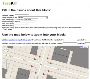
 Data entry. It’s an unglamorous job, but someone’s got to do it. We’ve got a stack of handwritten worksheets from our summer tree mapping parties that need to be fed through a web-based form. Bit by bit, we plug in the numbers… and a map of the urban forest comes out the other end. Data entry may be a drag, but sometimes the outcome is well worth it. Besides, when else do we get a chance to catch up on listening to archives at WFMU?
Category Archives: technical
DPR Contract for Feasibility Study
A huge thank you to the Department of Parks and Rec for funding a feasibility study for working with TreeKIT. It is great to finally have a bit of funding to get our online form and database working as well as enlist Sophia Parafina to get the geometry automagically drawing from the linear measurements.
Once we have this data, we will study how TreeKIT’s super-accurate spatial locations and bed dimensions could be matched up with existing city data. This will enable the migration of historical maintenance records to the correct locations, and provide the basis for stewardship applications.
Upper Manhattan and the expanding TreeKit team
During the Conflux workshop we met some great folks from upper Manhattan. Basia and Michael have been organizing neighbors and business owners and stewarding trees around Montefiore Park for several years. Beginning on October 18th, we’ve been working together to bring TreeKit to their neighborhood, not only to map trees but as a community event to engage people in the long-term plan to close the road along the park and redesign the area. On the technical side, Jen and Shira have been deriving start and end points for the area between 133rd and 154th from Convent Avenue to Riverside Drive to update the form. The points as well as contextual information like building footprints and sidewalk edges are exported from ArcGIS as KMZ and added to the Google Map on our form.
Tree tagging brainstorm with PlanningCorps
Yesterday, nine of us (TreeKIT/PlanningCorps crew plus a few new faces) gathered on the top floor of OpenGeo to hash out some of the many ideas that have been floating around about tree tagging.
Placing tags on trees would be useful to either communicate or provide access to several types of information to people walking by:
– basic information about a tree (species, size/age, etc.)
– that the tree has been mapped by a community effort and added to a public database
– how the tree could be cared for, and how you can help
– who has been active in taking care of the tree
– other stuff
Technical-hypothetical discussions ranged from RFID, sidewalk stencils of unique IDs, portable dog tag printers, and biodegradable packs of fertilizer that could be laid over the soil. We realized that the moment when volunteers are actually out mapping is ideal for going ahead and hanging some kind of tag on the tree, but there is probably not time to hang any sort of unique ID on each tree while also rolling the wheel, recording the nearest address and all the rest of the protocol. By the end of the discussion, Brendan offered that as mappers measure a block segment, they could hang a single larger informational tag to invite locals to go online and print out their own tags for each tree, since now all that information would be part of a public database. There will be more coming on this over the leafless months.
Planning Corps experiments on us
Frank Hebbert, one of TreeKIT’s advisors, had the idea to organize a special workshop to evaluate our field mapping protocol. By sending out multiple teams to measure the same block, we could compare the variation in the results. PlanningCorps, an informal collective of skilled urbanists, stepped forward to help us with this effort. On August 28th, approximately 14 people met at Prospect Heights Community Farms, split into four teams, and set out to map the block bordered by Prospect Place, Underhill, Park Place, and Vanderbuilt. Landscape architect Michael Cluer was there to teach tree ID, and several members of PlanningCorps that were graduates of Cornell also brought their tree ID skills to bear.
The TreeKIT team sends a big thank you to PlanningCorps and Michael Cluer!
We will be evaluating the results over the next few weeks and will keep you posted.

