Urban Legends

Patrick Barry, the founding member of TreeKIT’s Advisory board, has added an important new map feature — a “legend” in and of itself (pun intended).

At long last, this legend helps explain the following:

  • When zoomed out, the map displays block edges color-coded by tree density.
  • When zoomed in, individual trees become visible. Trees are classified as “Alive,” “Dead,” “Stump,” or “Empty Bed.” “Alive” trees are graded into six size classes by diameter at breast hight.
  • When closely zoomed in, individual treebed rectangles become visible.

Thank you Patrick for this great addition to the map!


Designing Tree Bed Guards

TreeKIT is planning a design competition for innovative guards / seating / bike parking that helps protect trees and the soil beds they grow in. Stay tuned, and in the meantime, check out the above inspirational design by Roman Vrtiska.

This design by WXY Architecture + Urban Design wraps organically around a tree while providing seating. Unfortunately the metal slats were designed to deter skateboarding.

We’re starting to save our favorite tree guards designs here: http://pinterest.com/ebarry/tree-guards/ — consider adding some pins!

Tilemill map sneak peek

We’re using Tilemill to create maps of the data mapped by TreeKIT over the past year and a half. Trees are sized according to their trunk size, red indicates a standing dead tree, orange indicates a stump, and black indicates an empty bed ready to be replanted.

All of Prospect Heights, and portions of Woodside, Sunnyside, and Astoria are complete — which neighborhood will be next?

OpenTreeMap.org features TreeKIT

Our friends at Azavea have expanded the Urban Forest Map code base into what is now known as Open Tree Map. We are delighted to be among their partners!

Check out these instances of Open Tree Map around the United States:

The original, San Francisco, created by Amber, Kelaine, Josh, Dane and many others! – http://urbanforestmap.org/

New instances created by Azavea:
Philadelphia – http://phillytreemap.org/
Sacramento – http://www.greenprintmaps.org/map/

Get in touch if you are interested in helping bring Open Tree Map to New York City.

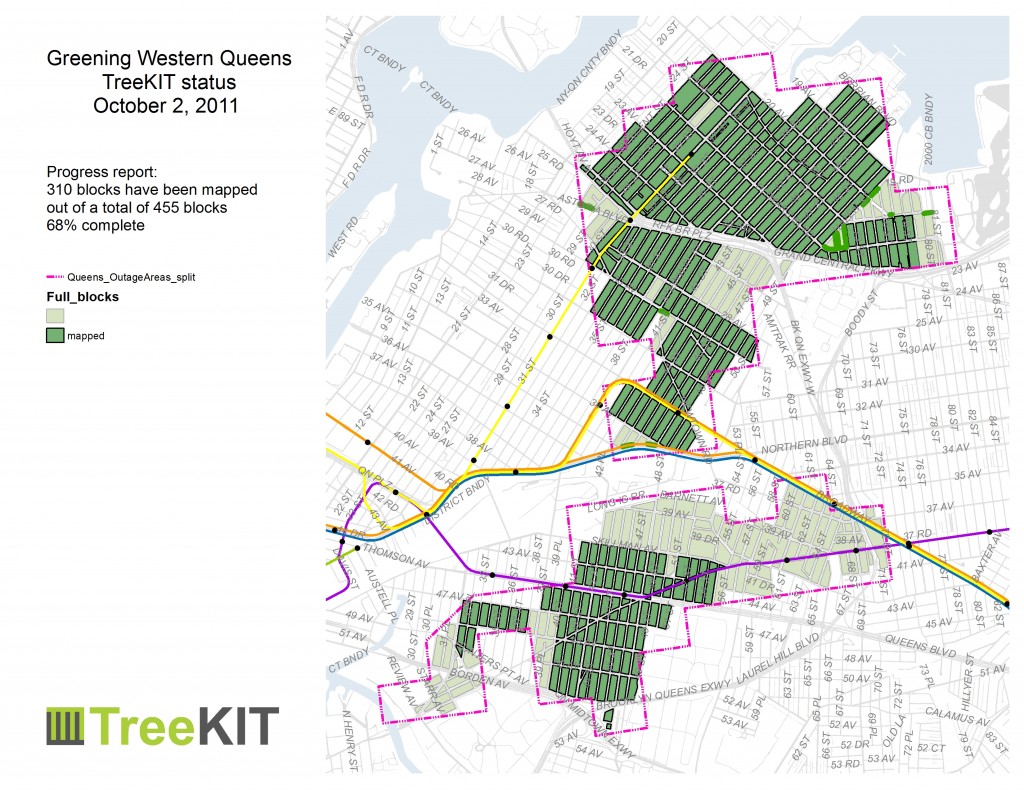
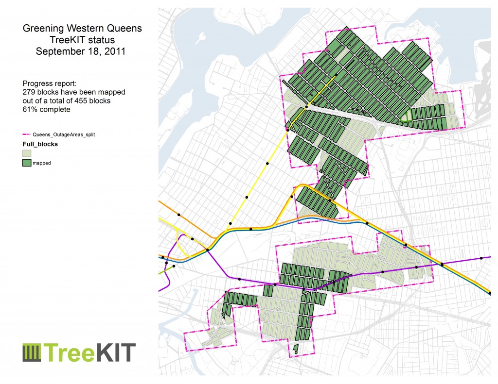
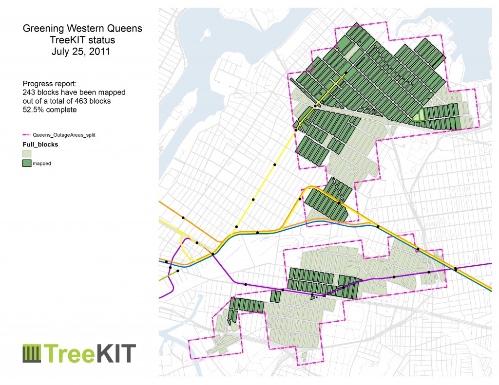
Fall 2011 update – 76% complete


Thanks to everyone who rolled blocks this summer, 76.2% of the Western Queens Outage areas have been mapped! You all made it happen!

Although we are still glad to set up parties directly with groups who want to map before the leaves drop in a few more weeks, the standing Saturday morning and afternoon sessions have come to a close for the year. Data entry continues in earnest in our new shiny postgres database courtesy of Sophia Parafina.